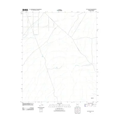
2011 Map of Dutch Flat SE
USGS Topo · Published 2011About this map
The McCracken Mountains anchor the southern reaches of this arid landscape, where desert water management is defined by isolated features like Hill Tank and Cedric Tank. This region of Mohave County is characterized by a network of drainage systems, most notably Crozier Wash and the somberly named Graveyard Wash, which cut through the terrain. The road network reflects a history of desert transit and perhaps local mining lore, with routes such as Alamo Crossing Rd, Bonanza Rd, and Lost Loot Rd crisscrossing the flats. These names suggest a period of exploration and resource seeking in a corner of the Arizona desert where seasonal water flow and rugged access routes dictate the pace of movement.
Find a feature on this map
15 named features on this map. Tap any name to fly to it.
Don’t see what you’re looking for? This feature index may not catch every label — zoom into the map to look around manually.
Map Details
Editions of this 2011 Dutch Flat SE Map
This is the sole edition of this map. No revisions or reprints were ever made.
Other maps of this area

1923 · Signal
USGS Topo · 1:250,000

1942 · Signal
USGS Topo · 1:250,000

1950 · Prescott
USGS Topo · 1:250,000

1954 · Prescott
USGS Topo · 1:250,000

1958 · Prescott
USGS Topo · 1:250,000

1959 · Prescott
USGS Topo · 1:250,000

1960 · Prescott
USGS Topo · 1:250,000

1965 · Prescott
USGS Topo · 1:250,000
1966 · Castaneda Hills
USGS Topo · 1:62,500

1966 · Artillery Peak
USGS Topo · 1:62,500