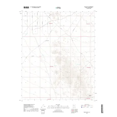
2018 Map of Dutch Flat SE
USGS Topo · Published 2018About this map
The McCracken Mountains dominate the southeastern portion of this landscape, rising sharply from the basin floor of the Mojave Desert. This arid region in Mohave County is characterized by significant alluvial features such as Crozier Wash and Graveyard Wash, which cut through the terrain and drain toward the lowlands of Dutch Flat. The map reveals a network of roads with names that evoke the region's western heritage, including Wagon Trail Rd, Lost Loot Rd, and Six Shooter Rd. Isolated water sources, critical for survival and land use in this desert environment, are represented by Hill Tank and Cedric Tank. While sparse in permanent structures, the area is meticulously gridded by township and range lines, reflecting the formal organization of these public lands under federal jurisdiction.
Find a feature on this map
25 named features on this map. Tap any name to fly to it.
Don’t see what you’re looking for? This feature index may not catch every label — zoom into the map to look around manually.
Map Details
Editions of this 2018 Dutch Flat SE Map
This is the sole edition of this map. No revisions or reprints were ever made.
Other maps of this area

1923 · Signal
USGS Topo · 1:250,000

1942 · Signal
USGS Topo · 1:250,000

1950 · Prescott
USGS Topo · 1:250,000

1954 · Prescott
USGS Topo · 1:250,000

1958 · Prescott
USGS Topo · 1:250,000

1959 · Prescott
USGS Topo · 1:250,000

1960 · Prescott
USGS Topo · 1:250,000

1965 · Prescott
USGS Topo · 1:250,000
1966 · Castaneda Hills
USGS Topo · 1:62,500

1966 · Artillery Peak
USGS Topo · 1:62,500