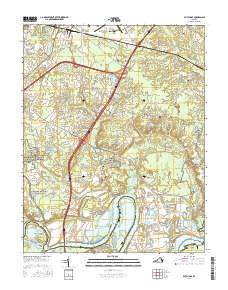
2016 Map of Dutch Gap
USGS Topo · Published 2016About this map
The Richmond National Battlefield Park preserves the complex Civil War legacy of Henrico County, where the southern loop of the James River winds through historic necks and islands. This modern survey illustrates the layered geography of the region, from the industrial activity at the Richmond Yacht Basin to the preserved marshlands of Aiken Swamp and The Slash. The map details the intricate waterways of the Jones Neck Cutoff and Dutch Gap, which fundamentally altered the river's course for navigation.
Find a feature on this map
122 named features on this map. Tap any name to fly to it.
Don’t see what you’re looking for? This feature index may not catch every label — zoom into the map to look around manually.
Map Details
Editions of this 2016 Dutch Gap Map
This is the sole edition of this map. No revisions or reprints were ever made.
Other maps of this area

1894 · Bermuda Hundred
USGS Topo · 1:62,500

1894 · Richmond
USGS Topo · 1:62,500

1895 · Richmond
USGS Topo · 1:62,500

1918 · Charles City
USGS Topo · 1:62,500

1920 · King William
USGS Topo · 1:62,500

1934 · Seven Pines
USGS Topo · 1:24,000

1934 · Richmond
USGS Topo · 1:24,000

1938 · Dutch Gap
USGS Topo · 1:24,000

1938 · Seven Pines
USGS Topo · 1:31,680

1938 · Drewrys Bluff
USGS Topo · 1:24,000