
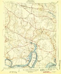
1943 Map of Dutch Gap
USGS Topo · Published 1943About this map
Curles Neck Plantation and the surrounding agricultural bottomlands of the James River define this 1943 landscape in Henrico County. This survey follows a winding river corridor where massive meanders create distinct peninsulas like Jones Neck and Curles Neck, linked by the engineered Dutch Gap Channel and Meadowville Channel. The era's transportation network is anchored by the Chesapeake and Ohio Railroad to the north and a web of historic roads including Darbytown Road and Varina Road.
Find a feature on this map
69 named features on this map. Tap any name to fly to it.
Don’t see what you’re looking for? This feature index may not catch every label — zoom into the map to look around manually.
Map Details
Editions of this 1943 Dutch Gap Map
2 editions found
Other maps of this area

1894 · Bermuda Hundred
USGS Topo · 1:62,500

1894 · Richmond
USGS Topo · 1:62,500

1895 · Richmond
USGS Topo · 1:62,500

1918 · Charles City
USGS Topo · 1:62,500

1920 · King William
USGS Topo · 1:62,500

1934 · Seven Pines
USGS Topo · 1:24,000

1934 · Richmond
USGS Topo · 1:24,000

1938 · Dutch Gap
USGS Topo · 1:24,000

1938 · Seven Pines
USGS Topo · 1:31,680

1938 · Drewrys Bluff
USGS Topo · 1:24,000