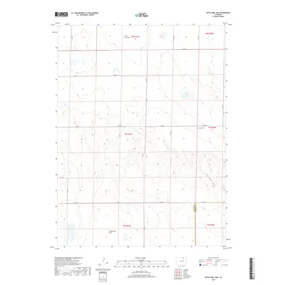
2019 Map of Dutch Girl Lake
USGS Topo · Published 2019About this map
Seven Cross Hill and the seasonal depressions of Dutch Girl Lake define this high plains landscape along the border of Weld and Morgan counties. The 2019 survey shows a sparsely populated area dominated by a grid of county roads, such as Co RD 87 and Co RD 74, which partition the terrain into large ranching or agricultural sections. This map provides a contemporary look at the rural infrastructure in the northern Colorado grasslands, where water features like Coal Bank Draw and the alkaline Greasewood Flats dictate the local ecology.
Find a feature on this map
22 named features on this map. Tap any name to fly to it.
Don’t see what you’re looking for? This feature index may not catch every label — zoom into the map to look around manually.
Map Details
Editions of this 2019 Dutch Girl Lake Map
This is the sole edition of this map. No revisions or reprints were ever made.
Other maps of this area

1950 · Greasewood Lake
USGS Topo · 1:24,000

1951 · Sunken Lake
USGS Topo · 1:24,000

1951 · Point Of Rocks
USGS Topo · 1:24,000

1954 · Greeley
USGS Topo · 1:250,000

1957 · Greeley
USGS Topo · 1:250,000

1958 · Greeley
USGS Topo · 1:250,000

1961 · Greeley
USGS Topo · 1:250,000

1964 · Greeley
USGS Topo · 1:250,000

1965 · Greeley
USGS Topo · 1:250,000

1972 · Dutch Girl Lake
USGS Topo · 1:24,000