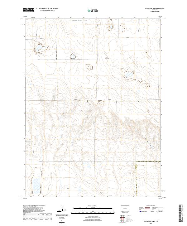
2022 Map of Dutch Girl Lake
USGS Topo · Published 2022About this map
Seven Cross Hill rises above a high plains landscape defined by a precise grid of rural section lines and county roads on the boundary of Weld and Morgan counties. This high-desert terrain is marked by seasonal drainages and subtle topographic shifts, most notably Coal Bank Draw in the east and the expansive Greasewood Flats in the southwest. For family historians and local researchers, the Pilgrim Cem serves as a significant genealogical landmark, situated near the intersection of Co Rd 80 and Co Rd 97. The map illustrates the persistent structure of Colorado's grazing and agricultural lands, where the placement of roads like Co RD 86 and Co Rd 74 follows the strict cardinal lines of the Public Land Survey System, anchored by townships such as t7n r61w.
Find a feature on this map
21 named features on this map. Tap any name to fly to it.
Don’t see what you’re looking for? This feature index may not catch every label — zoom into the map to look around manually.
Map Details
Editions of this 2022 Dutch Girl Lake Map
This is the sole edition of this map. No revisions or reprints were ever made.
Other maps of this area

1950 · Greasewood Lake
USGS Topo · 1:24,000

1951 · Sunken Lake
USGS Topo · 1:24,000

1951 · Point Of Rocks
USGS Topo · 1:24,000

1954 · Greeley
USGS Topo · 1:250,000

1957 · Greeley
USGS Topo · 1:250,000

1958 · Greeley
USGS Topo · 1:250,000

1961 · Greeley
USGS Topo · 1:250,000

1964 · Greeley
USGS Topo · 1:250,000

1965 · Greeley
USGS Topo · 1:250,000

1972 · Dutch Girl Lake
USGS Topo · 1:24,000