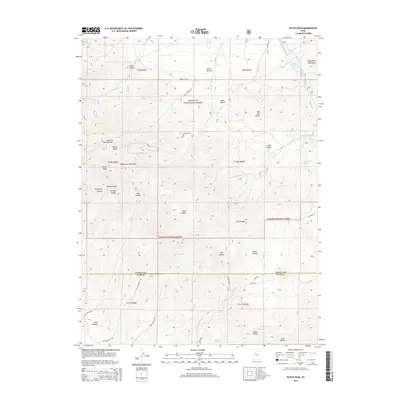
2014 Map of Dutch Peak
USGS Topo · Published 2014About this map
Dutch Peak stands as the central landmark in this high-elevation portion of the Wasatch National Forest, where the Sheeprock Mountains meet the West Tintic Mountains. This 2014 survey captures a landscape defined by sharp ridges and deep drainage systems, crossing the county line between Tooele Co and Juab Co. Resource management and seasonal water access are evident through features like the Vernon Reservoir and numerous isolated water sources including Chokecherry Spring and Indian Springs. The terrain is marked by descriptive local nomenclature for its canyons and hollows, such as Hard to Beat Canyon, Burned Canyon, and Snow Hollow. A network of unpaved corridors like Dutch Creek Rd and Pole Canyon Rd provides the primary access through these national forest lands, tracing the natural contours of the mountain passes.
Find a feature on this map
46 named features on this map. Tap any name to fly to it.
Don’t see what you’re looking for? This feature index may not catch every label — zoom into the map to look around manually.
Map Details
Editions of this 2014 Dutch Peak Map
This is the sole edition of this map. No revisions or reprints were ever made.
Other maps of this area

1885 · Sevier Desert
USGS Topo · 1:250,000

1885 · Tooele Valley
USGS Topo · 1:250,000

1953 · Tooele
USGS Topo · 1:250,000

1953 · Delta
USGS Topo · 1:250,000

1955 · Tooele
USGS Topo · 1:250,000

1958 · Delta
USGS Topo · 1:250,000

1962 · Delta
USGS Topo · 1:250,000

1963 · Maple Peak
USGS Topo · 1:24,000
1963 · Sabie Mountain
USGS Topo · 1:24,000

1963 · Dutch Peak
USGS Topo · 1:24,000