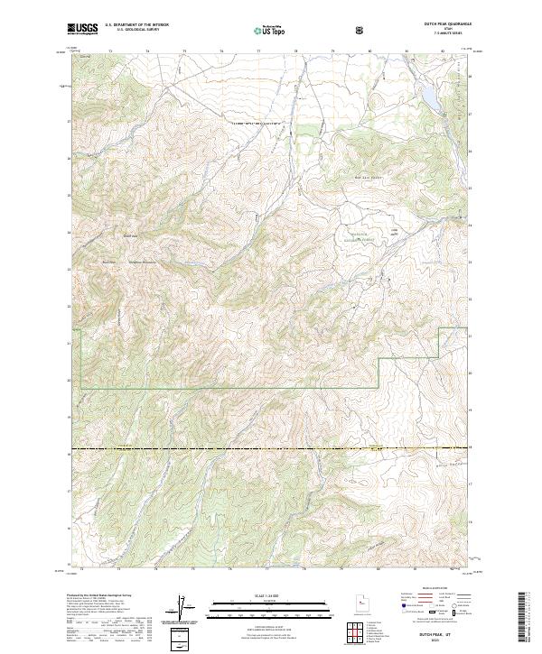
2023 Map of Dutch Peak
USGS Topo · Published 2023About this map
The Wasatch National Forest dominates this high-altitude landscape where the Sheeprock Mountains meet the West Tintic Mountains. The map reveals a rugged network of drainage systems and ridges, centered on the towering Dutch Peak and neighboring Black Peak. This area serves as a critical watershed, feeding several named water sources such as Dutch Creek, Bennion Creek, and the isolated Indian Springs. A complex system of canyons and hollows, including Harker Canyon and Pole Canyon, provides a look at the natural corridors that historically dictated movement through the range. Remote routes like Pole Cyn Rd and Elkers Cutoff connect the drainages, reflecting the ongoing use of this terrain for forest management and transit between Tooele and Juab counties. Notable landmarks like Red Skin Knolls and Lion Hill punctuate the high ridges, providing distinct orientation points for those navigating these summits.
Find a feature on this map
35 named features on this map. Tap any name to fly to it.
Don’t see what you’re looking for? This feature index may not catch every label — zoom into the map to look around manually.
Map Details
Editions of this 2023 Dutch Peak Map
This is the sole edition of this map. No revisions or reprints were ever made.
Other maps of this area

1885 · Sevier Desert
USGS Topo · 1:250,000

1885 · Tooele Valley
USGS Topo · 1:250,000

1953 · Tooele
USGS Topo · 1:250,000

1953 · Delta
USGS Topo · 1:250,000

1955 · Tooele
USGS Topo · 1:250,000

1958 · Delta
USGS Topo · 1:250,000

1962 · Delta
USGS Topo · 1:250,000

1963 · Maple Peak
USGS Topo · 1:24,000
1963 · Sabie Mountain
USGS Topo · 1:24,000

1963 · Dutch Peak
USGS Topo · 1:24,000