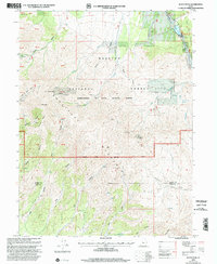
1998 Map of Dutch Peak
USGS Topo · Published 2002About this map
The high ridges of the Sheeprock Mountains and Tintic Mountains dominate this survey, marking the intersection of the Spanish Fork Ranger District and Wasatch National Forest. The landscape is a network of steep drainages, including Bear Canyon, Joes Canyon, and Dutch Creek, which channel water toward Vernon Reservoir in the northeast. This area shows evidence of significant prospecting and resource extraction throughout the late 20th century, with numerous Mine and Prospects sites located near Dutch Peak and the surrounding peaks.
Find a feature on this map
41 named features on this map. Tap any name to fly to it.
Don’t see what you’re looking for? This feature index may not catch every label — zoom into the map to look around manually.
Map Details
Editions of this 1998 Dutch Peak Map
This is the sole edition of this map. No revisions or reprints were ever made.
Other maps of this area

1885 · Sevier Desert
USGS Topo · 1:250,000

1885 · Tooele Valley
USGS Topo · 1:250,000

1953 · Tooele
USGS Topo · 1:250,000

1953 · Delta
USGS Topo · 1:250,000

1955 · Tooele
USGS Topo · 1:250,000

1958 · Delta
USGS Topo · 1:250,000

1962 · Delta
USGS Topo · 1:250,000

1963 · Maple Peak
USGS Topo · 1:24,000
1963 · Sabie Mountain
USGS Topo · 1:24,000

1963 · Dutch Peak
USGS Topo · 1:24,000