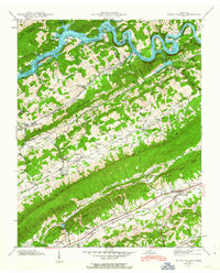
1941 Map of Dutch Valley
USGS Topo · Published 1963About this map
Clinch River Reservoir fills the northern basin of this 1941 landscape, defined by the sharp, parallel ridges of the Appalachian Valley. The Southern railroad line follows the narrow corridors between Log Mountain and Copper Ridge, connecting rural hubs like Washburn and Rutledge. These settlements are marked by a dense network of small family cemeteries and country churches, such as Liberty Hill Chapel and Locust Grove Ch, reflecting a deeply established rural community before the mid-century.
Find a feature on this map
78 named features on this map. Tap any name to fly to it.
Don’t see what you’re looking for? This feature index may not catch every label — zoom into the map to look around manually.
Map Details
Editions of this 1941 Dutch Valley Map
4 editions found
Other maps of this area

1883 · Morristown
USGS Topo · 1:125,000

1893 · Morristown
USGS Topo · 1:125,000

1895 · Morristown
USGS Topo · 1:125,000

1897 · Maynardville
USGS Topo · 1:125,000

1900 · Maynardville
USGS Topo · 1:125,000

1935 · Luttrell
USGS Topo · 1:24,000

1935 · Tate Springs
USGS Topo · 1:48,000

1935 · Straw Plains
USGS Topo · 1:48,000

1935 · Joppa
USGS Topo · 1:24,000

1935 · Howard Quarter
USGS Topo · 1:24,000