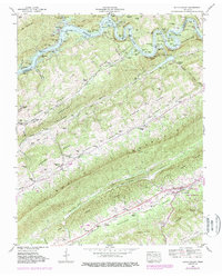
1941 Map of Dutch Valley
USGS Topo · Published 1987About this map
Rutledge and the surrounding Ridge-and-Valley terrain are shown at a transformative moment in the 1940s, as the impoundment of Norris Lake reshaped the northern boundary along the Clinch River. The landscape is characterized by its linear geography, with the massive Clinch Mountain and Copper Ridge dictating the path of the Southern railroad and historic settlements. Small rural hubs such as Washburn, Liberty Hill, and Lulaville are documented alongside numerous family-named landmarks like Beeler Mill and Williams Springs. The map provides a detailed view of the local social fabric, recording the locations of many small cemeteries and country churches, including Salem Church and Locust Grove Church, which served the scattered farming communities of Richland Valley and Dutch Valley Ridge before modern development altered these traditional Tennessee corridors.
Find a feature on this map
75 named features on this map. Tap any name to fly to it.
Don’t see what you’re looking for? This feature index may not catch every label — zoom into the map to look around manually.
Map Details
Editions of this 1941 Dutch Valley Map
4 editions found
Other maps of this area

1883 · Morristown
USGS Topo · 1:125,000

1893 · Morristown
USGS Topo · 1:125,000

1895 · Morristown
USGS Topo · 1:125,000

1897 · Maynardville
USGS Topo · 1:125,000

1900 · Maynardville
USGS Topo · 1:125,000

1935 · Luttrell
USGS Topo · 1:24,000

1935 · Tate Springs
USGS Topo · 1:48,000

1935 · Straw Plains
USGS Topo · 1:48,000

1935 · Joppa
USGS Topo · 1:24,000

1935 · Howard Quarter
USGS Topo · 1:24,000