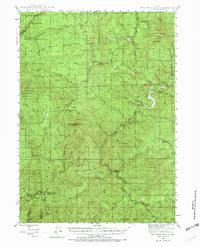
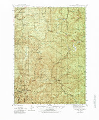
1946 Map of Dutchman Butte
USGS Topo · Published 1971About this map
Dutchman Butte Lookout and Ninemile Mtn Lookout stand as prominent fire watch points overlooking the convergence of Douglas, Josephine, and Curry Counties in the mid-1940s. This survey of the Siskiyou National Forest reveals a landscape managed through remote outposts like the Bradford Warden Sta and Middle Creek Warden Sta. High ridges including Emerson Ridge and Sixmile Ridge separate a complex network of drainages, where the Middle Fork Coquille River and Cow Creek carve deep through the terrain. The presence of several meadows, such as Walker Prairie, Jackass Prairie, and Horse Prairie, indicates breaks in the heavy timber that defined this era of Pacific Northwest forestry. These specific geographic benchmarks and station names provide essential context for researchers tracing the early 20th-century history of forest service operations and land use in southern Oregon.
Find a feature on this map
102 named features on this map. Tap any name to fly to it.
Don’t see what you’re looking for? This feature index may not catch every label — zoom into the map to look around manually.
Map Details
Editions of this 1946 Dutchman Butte Map
6 editions found
Other maps of this area

1897 · Roseburg
USGS Topo · 1:125,000

1900 · Roseburg
USGS Topo · 1:125,000

1904 · Riddle
USGS Topo · 1:125,000

1928 · Sitkum
USGS Topo · 1:125,000

1946 · Galice
USGS Topo · 1:62,500

1946 · Dutchman Butte
USGS Topo · 1:62,500

1948 · Galice
USGS Topo · 1:62,500

1948 · Dutchman Butte
USGS Topo · 1:62,500

1954 · Bone Mountain
USGS Topo · 1:62,500

1954 · Marial
USGS Topo · 1:62,500