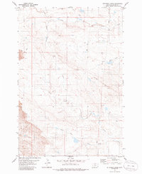
1979 Map of Dutchman Creek
USGS Topo · Published 1985About this map
Blue Mud Hills dominate the northern landscape of this Carter County quadrangle, where the terrain transitions into a series of drainage basins defined by the Dutchman Creek and Cabin Creek systems. The map reflects a sparsely settled ranching or resource extraction environment during the late 1970s, evidenced by a solitary Drill Hole and a Pipeline that cuts across the eastern sections. The hydrology of the area is quite complex, with the North Fork Corral Creek and South Fork Corral Creek converging in the southern half of the sheet. Modern infrastructure is limited to unimproved roads and a specific Spillway on South Creek, suggesting targeted water management in an otherwise open, high-plains landscape. The lack of named towns emphasizes the rural character of this corner of Montana, where named landmarks are primarily natural features or industrial markers.
Find a feature on this map
13 named features on this map. Tap any name to fly to it.
Don’t see what you’re looking for? This feature index may not catch every label — zoom into the map to look around manually.
Map Details
Editions of this 1979 Dutchman Creek Map
2 editions found
Other maps of this area

1954 · Ekalaka
USGS Topo · 1:250,000

1956 · Ekalaka
USGS Topo · 1:250,000

1958 · Ekalaka
USGS Topo · 1:250,000

1965 · Ekalaka
USGS Topo · 1:250,000

1979 · W L Butte
USGS Topo · 1:24,000

1979 · Dutchman Creek
USGS Topo · 1:24,000

1979 · Dead Boy Divide
USGS Topo · 1:24,000

1979 · Ikey Creek
USGS Topo · 1:24,000

1979 · Chalk Buttes
USGS Topo · 1:24,000
1979 · Davis Creek East
USGS Topo · 1:24,000