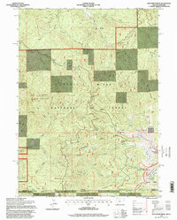
1996 Map of Dutchman Peak
USGS Topo · Published 1998About this map
Siskiyou Mountains terrain dominates this 1996 survey, where the high-altitude border between Oregon and California is marked by a network of peaks, glades, and remote ranching outposts. The Pacific Crest National Scenic Trail winds through the southern portion of the map, crossing Maple Dell Gap and passing near Observation Peak. This landscape is defined by its water resources and mineral prospects, featuring isolated points of interest like the Grubstake Mine and Beaver Ranch.
Find a feature on this map
54 named features on this map. Tap any name to fly to it.
Don’t see what you’re looking for? This feature index may not catch every label — zoom into the map to look around manually.
Map Details
Editions of this 1996 Dutchman Peak Map
This is the sole edition of this map. No revisions or reprints were ever made.
Other maps of this area

1886 · Shasta
USGS Topo · 1:250,000

1891 · Ashland
USGS Topo · 1:250,000

1893 · Ashland
USGS Topo · 1:250,000

1894 · Shasta
USGS Topo · 1:250,000

1897 · Ashland
USGS Topo · 1:250,000

1908 · Grants Pass
USGS Topo · 1:125,000

1914 · Seiad
USGS Topo · 1:125,000

1922 · Seiad
USGS Topo · 1:125,000

1932 · Yreka
USGS Topo · 1:96,000

1938 · Medford
USGS Topo · 1:125,000