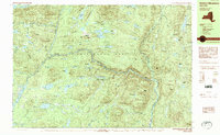
1989 Map of Dutton Mountain
USGS Topo · Published 1989About this map
The Hudson River carves a central path through this section of the Adirondack Park, where it meets the confluence of the Indian River and the Cedar River. In this late-twentieth-century landscape, private wilderness enclaves and organized camps define the human presence among the peaks. The Northwoods Club, Moose Pond Club, and Gooley Club are prominent landmarks, reflecting the long tradition of recreational conservation in the High Peaks region. To the east, the Boreas River winds through the township of Minerva, while the southern reaches of the map are dominated by the extensive Abanakee Lake. The survey details a terrain of named summits like Dutton Mountain and Bad Luck Mountain, connected by a network of waterways including McGinn Brook and Meadow Brook that flow through the vast state-protected forest.
Find a feature on this map
114 named features on this map. Tap any name to fly to it.
Don’t see what you’re looking for? This feature index may not catch every label — zoom into the map to look around manually.
Map Details
Editions of this 1989 Dutton Mountain Map
This is the sole edition of this map. No revisions or reprints were ever made.
Other maps of this area

1895 · North Creek
USGS Topo · 1:62,500

1897 · North Creek
USGS Topo · 1:62,500

1897 · Schroon Lake
USGS Topo · 1:62,500

1898 · Newcomb
USGS Topo · 1:62,500

1898 · Thirteenth Lake
USGS Topo · 1:62,500

1899 · Indian Lake
USGS Topo · 1:62,500

1901 · Newcomb
USGS Topo · 1:62,500

1902 · Indian Lake
USGS Topo · 1:62,500

1903 · Blue Mountain
USGS Topo · 1:62,500

1950 · Glens Falls
USGS Topo · 1:250,000