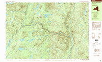
1997 Map of Dutton Mountain
USGS Topo · Published 2000About this map
Adirondack Park terrain dominates this 1997 survey, where the Cedar River and Hudson River corridor define the landscape of the Newcomb, Minerva, and Indian Lake townships. Private recreational history is prominent on this map, which identifies established grounds like the Gooley Club and Northwoods Club, alongside youth camps such as Camp Che-na-wah and Camp Baco. The area's complex hydrology is visible in the numerous high-elevation water bodies like OK Slip Pond and Big Bad Luck Pond, which feed into dramatic drops including the OK Slip Falls and Virgin Falls. Local industrial traces are noted at Crusher Hill, while the rugged relief is punctuated by summits like Harris Rift Mountain and Black Mountain. This survey provides a record of the remote interior of Essex County before the turn of the millennium.
Find a feature on this map
118 named features on this map. Tap any name to fly to it.
Don’t see what you’re looking for? This feature index may not catch every label — zoom into the map to look around manually.
Map Details
Editions of this 1997 Dutton Mountain Map
This is the sole edition of this map. No revisions or reprints were ever made.
Other maps of this area

1895 · North Creek
USGS Topo · 1:62,500

1897 · North Creek
USGS Topo · 1:62,500

1897 · Schroon Lake
USGS Topo · 1:62,500

1898 · Newcomb
USGS Topo · 1:62,500

1898 · Thirteenth Lake
USGS Topo · 1:62,500

1899 · Indian Lake
USGS Topo · 1:62,500

1901 · Newcomb
USGS Topo · 1:62,500

1902 · Indian Lake
USGS Topo · 1:62,500

1903 · Blue Mountain
USGS Topo · 1:62,500

1950 · Glens Falls
USGS Topo · 1:250,000