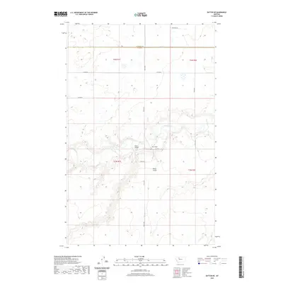
2020 Map of Dutton NE
USGS Topo · Published 2020About this map
The Teton River meanders through this portion of the northern Montana prairie, cutting a deep valley that defines the local topography. This 2020 map documents the rural character of the borderlands between Pondera and Teton counties. The landscape is marked by significant drainage features such as Hunt Coulee and Kinley Coulee, which channel runoff toward the river. Human infrastructure is primarily concentrated along the section lines, with roads like Broadview Rd and 20th Ln Ne providing access across the vast agricultural and grazing lands. A notable crossing point at Kerr Bridge provides a vital link across the river, while the grid of the Public Land Survey System, including t26n r1e and t25n r1e, dictates the layout of the region's ranching and farming operations.
Find a feature on this map
16 named features on this map. Tap any name to fly to it.
Don’t see what you’re looking for? This feature index may not catch every label — zoom into the map to look around manually.
Map Details
Editions of this 2020 Dutton NE Map
This is the sole edition of this map. No revisions or reprints were ever made.
Other maps of this area

1886 · Great Falls
USGS Topo · 1:250,000

1920 · Conrad
USGS Topo · 1:125,000

1949 · Timber Coulee
USGS Topo · 1:62,500

1950 · Timber Coulee
USGS Topo · 1:62,500

1950 · Dutton
USGS Topo · 1:62,500

1954 · Great Falls
USGS Topo · 1:250,000

1954 · Shelby
USGS Topo · 1:250,000

1957 · Great Falls
USGS Topo · 1:250,000

1958 · Shelby
USGS Topo · 1:250,000

1967 · Fowler Coulee SW
USGS Topo · 1:24,000