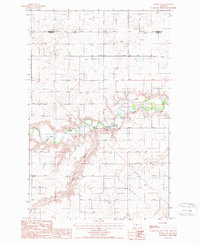
1987 Map of Dutton NE
USGS Topo · Published 1987About this map
Teton River cuts a deep, meandering course through the central plains of the state in this late 1980s survey. The landscape is defined by the sharp contrast between the level agricultural uplands and the eroded breaks along the river valley and Hunt Coulee. Along the river banks, infrastructure such as the Kerr Bridge, a Gaging Station, and a Pumping Station indicate the vital role of water management in this high-plains environment. Industrial activity is concentrated in the northern portion of the map within a designated Oil Field, while several Gravel extraction sites are located near the river's edge. The map also records the boundary between Pondera Co and Teton Co, alongside modern energy infrastructure including a Pipeline and the Owp Trans Line.
Find a feature on this map
11 named features on this map. Tap any name to fly to it.
Don’t see what you’re looking for? This feature index may not catch every label — zoom into the map to look around manually.
Map Details
Editions of this 1987 Dutton NE Map
This is the sole edition of this map. No revisions or reprints were ever made.
Other maps of this area

1886 · Great Falls
USGS Topo · 1:250,000

1920 · Conrad
USGS Topo · 1:125,000

1949 · Timber Coulee
USGS Topo · 1:62,500

1950 · Timber Coulee
USGS Topo · 1:62,500

1950 · Dutton
USGS Topo · 1:62,500

1954 · Great Falls
USGS Topo · 1:250,000

1954 · Shelby
USGS Topo · 1:250,000

1957 · Great Falls
USGS Topo · 1:250,000

1958 · Shelby
USGS Topo · 1:250,000

1967 · Fowler Coulee SW
USGS Topo · 1:24,000