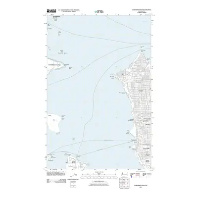
2011 Map of Duwamish Head
USGS Topo · Published 2011About this map
West Seattle and the western shoreline of King County dominate this coastal survey, where the urban grid meets the waters of Elliott Bay. The landscape is defined by its deep connection to the sound, evidenced by several maritime hubs including the Fauntleroy Ferry Landing and the Southworth Ferry Landing. Inland, residential developments like High Point, Arbor Heights, and Roxbury Heights follow the rising terrain away from the coast. To the west, the map reaches across the water to Bainbridge Island, noting the settlement of Creosote and the prominent Restoration Point. A unique cultural feature is Tillicum Village on Blake Island, situated south of Eagle Harbor. The inclusion of landmarks like the Alki Point Lighthouse and the Southwest Myrtle Street Reservoir Dam provides a look at the essential infrastructure supporting these Puget Sound communities during the early 21st century.
Find a feature on this map
106 named features on this map. Tap any name to fly to it.
Don’t see what you’re looking for? This feature index may not catch every label — zoom into the map to look around manually.
Map Details
Editions of this 2011 Duwamish Head Map
This is the sole edition of this map. No revisions or reprints were ever made.
Other maps of this area

1894 · Seattle
USGS Topo · 1:62,500

1895 · Snohomish
USGS Topo · 1:125,000

1897 · Tacoma
USGS Topo · 1:125,000

1897 · Seattle
USGS Topo · 1:125,000

1900 · Tacoma
USGS Topo · 1:125,000

1908 · Seattle
USGS Topo · 1:62,500

1909 · Seattle Special
USGS Topo · 1:62,500

1937 · Port Orchard
USGS Topo · 1:62,500

1942 · Gig Harbor
USGS Topo · 1:62,500

1943 · Gig Harbor
USGS Topo · 1:62,500