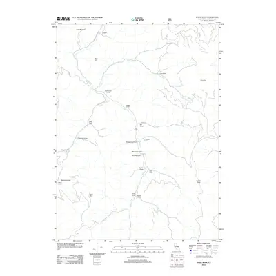
2012 Map of Duzel Rock
USGS Topo · Published 2012About this map
Duzel Rock stands as a prominent landmark in this upland landscape of Siskiyou County, where a network of gulches and ridges defines the geography. The drainage patterns of Moffett Cr and Cottonwood Cr dominate the northern and central sections, carving deep ravines through the terrain. The nomenclature of the area, featuring names like Moonshine Gulch, Whiskey Gulch, and Beef Corral Gulch, reflects the early agricultural and ranching history of this corner of Northern California. Access to these interior valleys is provided by routes such as Scarface Rd, which skirts Scarface Ridge and Bald Hill. This 2012 survey illustrates a landscape largely shaped by its watercourses and high peaks, including Piney Mountain and Antelope Mountain, providing a clear record of the topographical features that have influenced land use and transit for generations.
Find a feature on this map
30 named features on this map. Tap any name to fly to it.
Don’t see what you’re looking for? This feature index may not catch every label — zoom into the map to look around manually.
Map Details
Editions of this 2012 Duzel Rock Map
This is the sole edition of this map. No revisions or reprints were ever made.
Other maps of this area

1886 · Shasta
USGS Topo · 1:250,000

1894 · Shasta
USGS Topo · 1:250,000

1922 · Shasta Valley Sheet No 3 S
USGS Topo · 1:24,000

1923 · Sawyers Bar
USGS Topo · 1:125,000

1931 · Etna
USGS Topo · 1:96,000

1932 · Yreka
USGS Topo · 1:96,000

1934 · Etna
USGS Topo · 1:125,000

1939 · Yreka
USGS Topo · 1:125,000

1948 · Weed
USGS Topo · 1:250,000

1950 · Weed
USGS Topo · 1:250,000