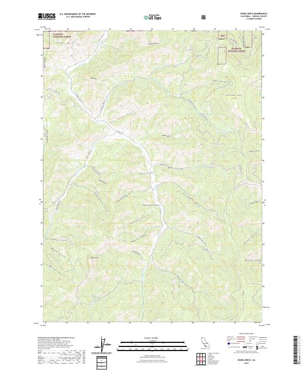
2022 Map of Duzel Rock
USGS Topo · Published 2022About this map
Klamath National Forest dominates the northern reaches of this landscape, where the Mineral Range defines the western edge. The terrain is deeply incised by a dense network of gulches, many bearing names that reflect the region's human history and utilitarian past, such as Moonshine Gulch, Whiskey Gulch, and Beef Corral Gulch. These drainages feed into the primary watercourses of Moffett Cr and Cottonwood Cr, which snake through the complex topography. The map reveals a land structured by both its natural features, like the prominent Duzel Rock and Antelope Mtn, and its network of mountain roads including Scarface Rd and Moffett Creek Rd. The presence of labels like Clapboard Gulch and Portugese Gulch suggests the diverse influences on the local nomenclature during the area's development.
Find a feature on this map
49 named features on this map. Tap any name to fly to it.
Don’t see what you’re looking for? This feature index may not catch every label — zoom into the map to look around manually.
Map Details
Editions of this 2022 Duzel Rock Map
This is the sole edition of this map. No revisions or reprints were ever made.
Other maps of this area

1886 · Shasta
USGS Topo · 1:250,000

1894 · Shasta
USGS Topo · 1:250,000

1922 · Shasta Valley Sheet No 3 S
USGS Topo · 1:24,000

1923 · Sawyers Bar
USGS Topo · 1:125,000

1931 · Etna
USGS Topo · 1:96,000

1932 · Yreka
USGS Topo · 1:96,000

1934 · Etna
USGS Topo · 1:125,000

1939 · Yreka
USGS Topo · 1:125,000

1948 · Weed
USGS Topo · 1:250,000

1950 · Weed
USGS Topo · 1:250,000