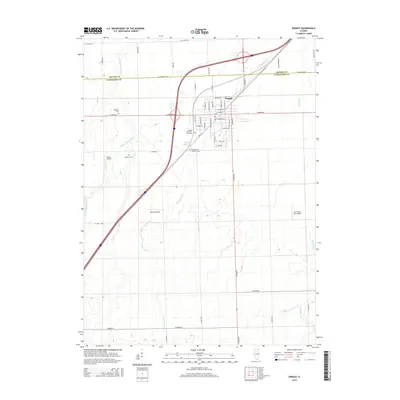
2015 Map of Dwight
USGS Topo · Published 2015About this map
Dwight sits at a critical junction of central Illinois transit, where the historic path of S Old IL-66 meets modern interstate corridors. The town's grid is dense with local history, evidenced by a cluster of civic and spiritual sites including the Dwight Old Town Cemetery and Mount Olivet Catholic Cem. This landscape is defined by the prairie-style drainage of the W Fork Mazon River and Gooseberry Cr, which wind through the agricultural sections surrounding the village. Aviation plays a surprisingly prominent role in the local geography, with three distinct private airstrips—Sauer Airport, Watters Airport, and Jim & Peg RLA Airport—marking the rural plots. The transition between Grundy and Livingston counties is clearly delineated, showing how the regional road network, from W Scully Rd to Odell Rd, ties these farming communities together near Dwight Lions Lake.
Find a feature on this map
53 named features on this map. Tap any name to fly to it.
Don’t see what you’re looking for? This feature index may not catch every label — zoom into the map to look around manually.
Map Details
Editions of this 2015 Dwight Map
This is the sole edition of this map. No revisions or reprints were ever made.
Other maps of this area

1935 · Pontiac
USGS Topo · 1:62,500

1939 · Pontiac
USGS Topo · 1:62,500

1947 · Cullom
USGS Topo · 1:62,500

1948 · Dwight
USGS Topo · 1:62,500

1949 · Cullom
USGS Topo · 1:62,500

1950 · Dwight
USGS Topo · 1:62,500

1958 · Odell
USGS Topo · 1:62,500

1958 · Aurora
USGS Topo · 1:250,000

1958 · Peoria
USGS Topo · 1:250,000

1961 · Aurora
USGS Topo · 1:250,000