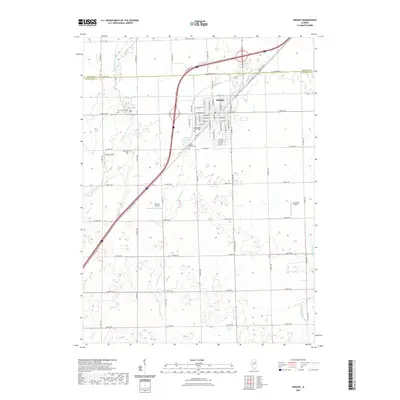
2021 Map of Dwight
USGS Topo · Published 2021About this map
Dwight serves as the focal point of this Illinois prairie landscape, where the modern interstate corridor intersects with the storied path of Old US Hwy 66. The town's grid is detailed with street names like W Mazon Ave and W Waupansie St, reflecting its historical development. Water features such as the W Fork Mazon River, Gooseberry Cr, and Woods Run drain the surrounding agricultural land, while Dwight Lions Lake provides a localized landmark near the town center.
Find a feature on this map
40 named features on this map. Tap any name to fly to it.
Don’t see what you’re looking for? This feature index may not catch every label — zoom into the map to look around manually.
Map Details
Editions of this 2021 Dwight Map
This is the sole edition of this map. No revisions or reprints were ever made.
Other maps of this area

1935 · Pontiac
USGS Topo · 1:62,500

1939 · Pontiac
USGS Topo · 1:62,500

1947 · Cullom
USGS Topo · 1:62,500

1948 · Dwight
USGS Topo · 1:62,500

1949 · Cullom
USGS Topo · 1:62,500

1950 · Dwight
USGS Topo · 1:62,500

1958 · Odell
USGS Topo · 1:62,500

1958 · Aurora
USGS Topo · 1:250,000

1958 · Peoria
USGS Topo · 1:250,000

1961 · Aurora
USGS Topo · 1:250,000