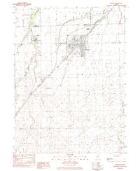
1983 Map of Dwight
USGS Topo · Published 1983About this map
The village of Dwight serves as the central hub of this 1980s landscape, positioned at the convergence of the Illinois Central Gulf and Conrail lines. This intersection of rail infrastructure alongside major thoroughfares like Vickery Rd and Dwight Rd highlights the area's role as a regional transit and agricultural corridor. The town's interior is well-documented, showing civic locations like the Po and High Sch, as well as recreational spaces such as Renfrew Park and the Dwight Country Club.
Find a feature on this map
29 named features on this map. Tap any name to fly to it.
Don’t see what you’re looking for? This feature index may not catch every label — zoom into the map to look around manually.
Map Details
Editions of this 1983 Dwight Map
This is the sole edition of this map. No revisions or reprints were ever made.
Other maps of this area

1935 · Pontiac
USGS Topo · 1:62,500

1939 · Pontiac
USGS Topo · 1:62,500

1947 · Cullom
USGS Topo · 1:62,500

1948 · Dwight
USGS Topo · 1:62,500

1949 · Cullom
USGS Topo · 1:62,500

1950 · Dwight
USGS Topo · 1:62,500

1958 · Odell
USGS Topo · 1:62,500

1958 · Aurora
USGS Topo · 1:250,000

1958 · Peoria
USGS Topo · 1:250,000

1961 · Aurora
USGS Topo · 1:250,000