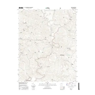
2016 Map of Dykes
USGS Topo · Published 2016About this map
Buck Creek winds through this section of the Cumberland Plateau, defining a landscape of deep hollows and narrow ridges within the Daniel Boone National Forest. The settlement pattern in this part of Pulaski County is characterized by small communities like Poplarville, Dykes, and Mount Victory, often situated near the heads of hollows or along ridge roads. The map reveals numerous family-named landmarks and historical sites, including Merritt Cem and Roper Cem, which offer significant value for genealogical research. Unique geological features such as The Sinks and Peter Cave Hollow illustrate the karst topography common to this region. Upland settlements like Piney Grove and Whetstone are connected by a network of local routes such as Cannonball Rd and Lizzie Ridge Rd, which trace the high ground above the many tributaries feeding the regional creek system.
Find a feature on this map
107 named features on this map. Tap any name to fly to it.
Don’t see what you’re looking for? This feature index may not catch every label — zoom into the map to look around manually.
Map Details
Editions of this 2016 Dykes Map
This is the sole edition of this map. No revisions or reprints were ever made.
Other maps of this area

1890 · Williamsburg
USGS Topo · 1:125,000

1893 · London
USGS Topo · 1:125,000

1894 · Williamsburg
USGS Topo · 1:125,000

1897 · London
USGS Topo · 1:125,000

1932 · Burnside
USGS Topo · 1:62,500

1935 · Somerset
USGS Topo · 1:62,500

1952 · Hail
USGS Topo · 1:24,000

1952 · Billows
USGS Topo · 1:24,000

1952 · Ano
USGS Topo · 1:24,000

1952 · Dykes
USGS Topo · 1:24,000