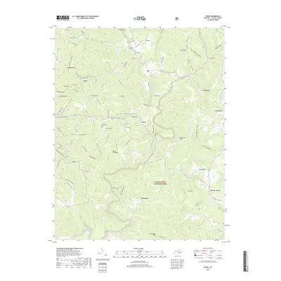
2019 Map of Dykes
USGS Topo · Published 2019About this map
Buck Creek winds through this deeply dissected portion of Pulaski County, shaping a landscape of steep ridges and narrow hollows within the Daniel Boone National Forest. Small settlements such as Dykes, Colo, and Poplarville are connected by a network of winding roads like Colo Grade Rd and Malvin Hill Church Rd, reflecting the rural character of the region. The map highlights numerous family-named landmarks and small burial grounds, including Woodall Cem and Merritt Cem, which are central to the area's genealogical history.
Find a feature on this map
103 named features on this map. Tap any name to fly to it.
Don’t see what you’re looking for? This feature index may not catch every label — zoom into the map to look around manually.
Map Details
Editions of this 2019 Dykes Map
This is the sole edition of this map. No revisions or reprints were ever made.
Other maps of this area

1890 · Williamsburg
USGS Topo · 1:125,000

1893 · London
USGS Topo · 1:125,000

1894 · Williamsburg
USGS Topo · 1:125,000

1897 · London
USGS Topo · 1:125,000

1932 · Burnside
USGS Topo · 1:62,500

1935 · Somerset
USGS Topo · 1:62,500

1952 · Hail
USGS Topo · 1:24,000

1952 · Billows
USGS Topo · 1:24,000

1952 · Ano
USGS Topo · 1:24,000

1952 · Dykes
USGS Topo · 1:24,000