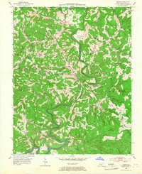
1952 Map of Dykes
USGS Topo · Published 1966About this map
Buck Creek carves a deep, winding path through the central landscape of this Pulaski County survey, creating the dramatic oxbow known as The Bent. This 1952 snapshot reveals a rural Kentucky economy defined by ridge-top settlements and hollow-bottom farming. Small communities like Poplarville, Dykes, and Malvin Hill are anchored by local institutions such as Wesley Chapel and Randall Chapel, alongside numerous rural schools like Haunted Cave Sch and Whetstone Sch. Much of the eastern and southern terrain falls within the Cumberland National Forest, where the Mt Victory Lookout Tower stands near Mount Victory. The presence of a Strip Mine in the northeast and family-named landmarks like White Lily Ridge and Nancy Jane Ridge reflect the long-standing intersection of forestry, small-scale mining, and generational landownership in the Cumberland Plateau.
Find a feature on this map
78 named features on this map. Tap any name to fly to it.
Don’t see what you’re looking for? This feature index may not catch every label — zoom into the map to look around manually.
Map Details
Editions of this 1952 Dykes Map
2 editions found
Other maps of this area

1890 · Williamsburg
USGS Topo · 1:125,000

1893 · London
USGS Topo · 1:125,000

1894 · Williamsburg
USGS Topo · 1:125,000

1897 · London
USGS Topo · 1:125,000

1932 · Burnside
USGS Topo · 1:62,500

1935 · Somerset
USGS Topo · 1:62,500

1952 · Hail
USGS Topo · 1:24,000

1952 · Billows
USGS Topo · 1:24,000

1952 · Ano
USGS Topo · 1:24,000

1952 · Dykes
USGS Topo · 1:24,000