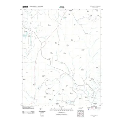
2010 Map of Dysartsville
USGS Topo · Published 2010About this map
The Tennessee River and the Big Sandy River define the watery landscape of this 1953 topographic survey of the Bruceton region. Transportation corridors like the Nc & St L Ry and the L & N Rr cut through the terrain, connecting established communities such as Camden, Eva, and Holladay. The map reveals a deeply rooted rural society, evidenced by the numerous congregations and burial grounds dotting the hills, including Mt Carmel Ch, Ebenezer Ch, and Bethlehem Cem. Local education in these small settlements is anchored by institutions like the Eva Sch and Chalk Level Sch. Further inland, landmarks like the Muddy Creek B S A Dam and Muddy Creek B S A Lake suggest organized land management and recreation. This map captures a moment of transition where traditional river-valley life meets the industrial expansion of mid-century Tennessee.
Find a feature on this map
129 named features on this map. Tap any name to fly to it.
Don’t see what you’re looking for? This feature index may not catch every label — zoom into the map to look around manually.
Map Details
Editions of this 2010 Dysartsville Map
This is the sole edition of this map. No revisions or reprints were ever made.
Other maps of this area

1905 · Morganton
USGS Topo · 1:125,000

1950 · Shelby
USGS Topo · 1:62,500

1953 · Charlotte
USGS Topo · 1:250,000

1954 · Charlotte
USGS Topo · 1:250,000

1956 · Benn Knob
USGS Topo · 1:24,000

1956 · Morganton South
USGS Topo · 1:24,000

1960 · Charlotte
USGS Topo · 1:250,000

1962 · Charlotte
USGS Topo · 1:250,000
1962 · Glen Alpine
USGS Topo · 1:24,000
1962 · Glenwood
USGS Topo · 1:24,000