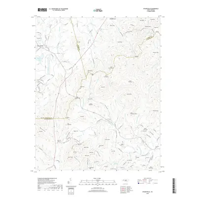
2019 Map of Dysartsville
USGS Topo · Published 2019About this map
Dysartsville and Brindletown anchor this rural landscape where the headwaters of the First Broad River and its numerous forks carve through a complex series of ridges and knobs. The map illustrates a region defined by its diverse terrain, including prominent landmarks like Pilot Mtn, Propst Mtn, and the distinctive Sisk Gap. The settlement pattern follows the contours of the land, with narrow roads like Dysartsville Rd and Nuckolls Dr connecting scattered homesteads and community centers.
Find a feature on this map
167 named features on this map. Tap any name to fly to it.
Don’t see what you’re looking for? This feature index may not catch every label — zoom into the map to look around manually.
Map Details
Editions of this 2019 Dysartsville Map
This is the sole edition of this map. No revisions or reprints were ever made.
Other maps of this area

1905 · Morganton
USGS Topo · 1:125,000

1950 · Shelby
USGS Topo · 1:62,500

1953 · Charlotte
USGS Topo · 1:250,000

1954 · Charlotte
USGS Topo · 1:250,000

1956 · Benn Knob
USGS Topo · 1:24,000

1956 · Morganton South
USGS Topo · 1:24,000

1960 · Charlotte
USGS Topo · 1:250,000

1962 · Charlotte
USGS Topo · 1:250,000
1962 · Glen Alpine
USGS Topo · 1:24,000
1962 · Glenwood
USGS Topo · 1:24,000