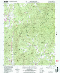
2002 Map of Dysartsville
USGS Topo · Published 2003About this map
Dysartsville and Brindletown anchor the landscape where the western Piedmont begins its ascent into the southern Appalachian foothills. This map details a region defined by its complex hydrology, with the South Fork Muddy Creek and Hoppers Creek flowing through the northern valleys, while the Little First Broad River and South Fork First Broad River drain the southern ridges. The extensive South Mountains State Game Lands dominate the eastern half of the quadrangle, preserving a network of peaks like Chestnut Knob and Sisk Gap.
Find a feature on this map
103 named features on this map. Tap any name to fly to it.
Don’t see what you’re looking for? This feature index may not catch every label — zoom into the map to look around manually.
Map Details
Editions of this 2002 Dysartsville Map
This is the sole edition of this map. No revisions or reprints were ever made.
Other maps of this area

1905 · Morganton
USGS Topo · 1:125,000

1950 · Shelby
USGS Topo · 1:62,500

1953 · Charlotte
USGS Topo · 1:250,000

1954 · Charlotte
USGS Topo · 1:250,000

1956 · Benn Knob
USGS Topo · 1:24,000

1956 · Morganton South
USGS Topo · 1:24,000

1960 · Charlotte
USGS Topo · 1:250,000

1962 · Charlotte
USGS Topo · 1:250,000
1962 · Glen Alpine
USGS Topo · 1:24,000
1962 · Glenwood
USGS Topo · 1:24,000