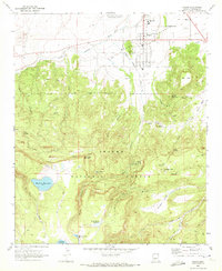
1969 Map of Eagar
USGS Topo · Published 1972About this map
Round Valley serves as the focal point for settlement in this high-altitude landscape, where the town of Eagar sits at the northern edge of the Apache National Forest. The 1969 field-checked survey reveals a complex irrigation network vital to local ranching and agriculture, including the Amity Ditch, Big Ditch, and Dutch Ditch. Moving south from the valley floor, the terrain climbs toward prominent landmarks like Flat Top and Round Mountain, eventually reaching high-country water features such as Mexican Hay Lake and the Atcheson Reservoir. The map captures the infrastructure of the era, from the Springerville-Eagar Municipal Airport and Round Valley High Sch to numerous cattle-related features like Corrals and water tanks. Pockets of activity extend into the forest at the Elderberry Spring Campground and the small settlement at Rosebud, illustrating the integration of town life with the surrounding timber and grazing lands.
Find a feature on this map
51 named features on this map. Tap any name to fly to it.
Don’t see what you’re looking for? This feature index may not catch every label — zoom into the map to look around manually.
Map Details
Editions of this 1969 Eagar Map
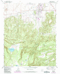
2 editions found
Other maps of this area

1886 · St Johns
USGS Topo · 1:250,000

1892 · St Johns
USGS Topo · 1:250,000

1922 · Nutrioso
USGS Topo · 1:125,000

1954 · Clifton
USGS Topo · 1:250,000

1954 · Saint Johns
USGS Topo · 1:250,000

1957 · Clifton
USGS Topo · 1:250,000

1957 · Saint Johns
USGS Topo · 1:250,000

1958 · Clifton
USGS Topo · 1:250,000

1958 · Saint Johns
USGS Topo · 1:250,000

1958 · Alpine
USGS Topo · 1:62,500