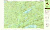
1989 Map of Eagle Bay
USGS Topo · Published 1989About this map
Big Moose Lake and the Chain Lakes anchor this late-twentieth-century study of the central Adirondack Park. The landscape is defined by an intricate network of glacial water bodies, from the sprawling Stillwater Res in the northwest to secluded basins like Queer Lake and Pigeon Lake. Small settlements and seasonal outposts such as Big Moose, Eagle Bay, and Camp Rondaxe are connected by a sparse road network, reflecting the area's enduring character as a destination for recreation and forestry.
Find a feature on this map
93 named features on this map. Tap any name to fly to it.
Don’t see what you’re looking for? This feature index may not catch every label — zoom into the map to look around manually.
Map Details
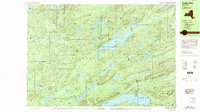
Editions of this 1989 Eagle Bay Map
2 editions found
Other maps of this area

1900 · Canada Lake
USGS Topo · 1:62,500

1901 · Old Forge
USGS Topo · 1:62,500

1903 · Big Moose
USGS Topo · 1:62,500

1903 · West Canada Lakes
USGS Topo · 1:62,500

1903 · Raquette Lake
USGS Topo · 1:62,500

1912 · Number Four
USGS Topo · 1:62,500

1912 · Mc Keever
USGS Topo · 1:62,500

1915 · Number Four
USGS Topo · 1:62,500

1950 · Utica
USGS Topo · 1:250,000

1954 · Old Forge
USGS Topo · 1:62,500