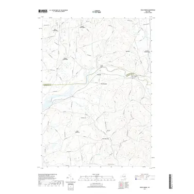
2019 Map of Eagle Bridge
USGS Topo · Published 2019About this map
The Hoosic River forms a winding natural boundary through this agricultural and wooded landscape, where the rural hamlets of Washington and Rensselaer counties meet. At the center of the valley stands the Buskirks Covered Bridge, a significant local landmark connecting the settlements of Buskirk and East Buskirk. The terrain is defined by low-lying wetlands and ponds like Wing Pond and Newcomb Pond, contrasted by the elevations of Nipmoose Hill and Oak Hill. A network of historic roads, including Meeting House Road and Lees Crossing Road, connects small communities such as West Cambridge and South Cambridge. To the south, the West Hoosick Rural Cem near the hamlet of West Hoosick provides a focal point for genealogical interest, situated among the drainage basins of Nipmoose Brook and Case Brook.
Find a feature on this map
99 named features on this map. Tap any name to fly to it.
Don’t see what you’re looking for? This feature index may not catch every label — zoom into the map to look around manually.
Map Details
Editions of this 2019 Eagle Bridge Map
This is the sole edition of this map. No revisions or reprints were ever made.
Other maps of this area

1893 · Cohoes
USGS Topo · 1:62,500

1895 · Cohoes
USGS Topo · 1:62,500

1895 · Cambridge
USGS Topo · 1:62,500

1897 · Hoosick
USGS Topo · 1:62,500

1898 · Cambridge
USGS Topo · 1:62,500

1898 · Cohoes
USGS Topo · 1:62,500

1900 · Taconic
USGS Topo · 1:125,000

1900 · Schuylerville
USGS Topo · 1:62,500

1901 · Cambridge
USGS Topo · 1:62,500

1903 · Mettawee
USGS Topo · 1:125,000