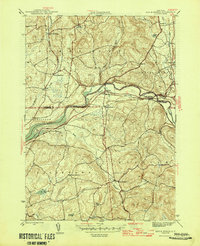
1946 Map of Eagle Bridge
USGS Topo · Published 1946About this map
The Hoosic River serves as a geographic and industrial anchor for this mid-1940s landscape, where the confluence of rail lines and water-driven geography shaped local commerce. At the settlement of Eagle Bridge, the Boston and Maine and Delaware and Hudson railroads intersected, establishing a vital transport node between the hill country of White Creek and the river valley. The map documents a rural infrastructure of one-room schoolhouses, including School No 3 and School No 4, alongside quiet burial grounds like Woodside Cem. This area, spanning the border of Washington and Rensselaer Counties, reveals a pattern of dispersed agricultural hamlets such as Buskirk, West Cambridge, and West Hoosick connected by winding valley roads and brooks like Wampecack Creek and Nipmoose Brook.
Find a feature on this map
34 named features on this map. Tap any name to fly to it.
Don’t see what you’re looking for? This feature index may not catch every label — zoom into the map to look around manually.
Map Details
Editions of this 1946 Eagle Bridge Map
2 editions found
Other maps of this area

1893 · Cohoes
USGS Topo · 1:62,500

1895 · Cohoes
USGS Topo · 1:62,500

1895 · Cambridge
USGS Topo · 1:62,500

1897 · Hoosick
USGS Topo · 1:62,500

1898 · Cambridge
USGS Topo · 1:62,500

1898 · Cohoes
USGS Topo · 1:62,500

1900 · Taconic
USGS Topo · 1:125,000

1900 · Schuylerville
USGS Topo · 1:62,500

1901 · Cambridge
USGS Topo · 1:62,500

1903 · Mettawee
USGS Topo · 1:125,000