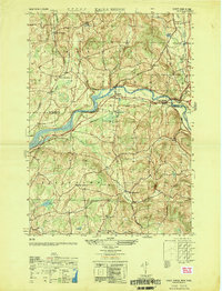
1950 Map of Eagle Bridge
USGS Topo · Published 1951About this map
The Hoosic River winds through this 1950 survey, serving as a geographic anchor for the rural communities along the border of Washington and Rensselaer Counties. The settlement at Eagle Bridge marks a critical junction where the Boston and Maine railroad tracks follow the river valley, facilitating the movement of goods and people between the small dairy and agricultural hamlets of the era. To the north, the terrain of Cambridge is dotted with upland farms and landmarks like Oak Hill, while the valley floor supports clusters of homes and commerce at Buskirk and East Buskirk.
Find a feature on this map
34 named features on this map. Tap any name to fly to it.
Don’t see what you’re looking for? This feature index may not catch every label — zoom into the map to look around manually.
Map Details
Editions of this 1950 Eagle Bridge Map
This is the sole edition of this map. No revisions or reprints were ever made.
Other maps of this area

1893 · Cohoes
USGS Topo · 1:62,500

1895 · Cohoes
USGS Topo · 1:62,500

1895 · Cambridge
USGS Topo · 1:62,500

1897 · Hoosick
USGS Topo · 1:62,500

1898 · Cambridge
USGS Topo · 1:62,500

1898 · Cohoes
USGS Topo · 1:62,500

1900 · Taconic
USGS Topo · 1:125,000

1900 · Schuylerville
USGS Topo · 1:62,500

1901 · Cambridge
USGS Topo · 1:62,500

1903 · Mettawee
USGS Topo · 1:125,000