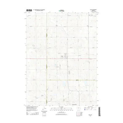
2014 Map of Eagle
USGS Topo · Published 2014About this map
Eagle sits at the heart of this landscape, a town defined by its grid of streets like F St and G St intersecting with the busy thoroughfare of O St. The surrounding countryside across the borders of Lancaster, Cass, and Otoe Counties is marked by a high concentration of pioneer-era burial sites, including Camp Creek Cem, Dunkers Cem, and Bunten Cem, which serve as vital markers for genealogical research.
Find a feature on this map
51 named features on this map. Tap any name to fly to it.
Don’t see what you’re looking for? This feature index may not catch every label — zoom into the map to look around manually.
Map Details
Editions of this 2014 Eagle Map
This is the sole edition of this map. No revisions or reprints were ever made.
Other maps of this area

1897 · Lincoln
USGS Topo · 1:125,000

1903 · Weeping Water
USGS Topo · 1:125,000

1929 · Weeping Water
USGS Topo · 1:125,000

1955 · Lincoln
USGS Topo · 1:250,000

1957 · Lincoln
USGS Topo · 1:250,000

1958 · Lincoln
USGS Topo · 1:250,000

1964 · Waverly
USGS Topo · 1:24,000

1964 · Walton
USGS Topo · 1:24,000
1966 · Greenwood
USGS Topo · 1:24,000
1966 · Murdock
USGS Topo · 1:24,000