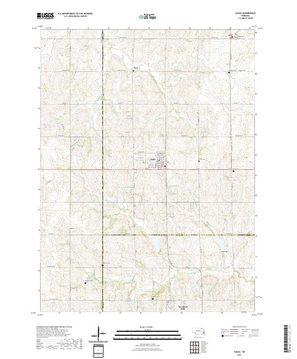
2021 Map of Eagle
USGS Topo · Published 2021About this map
Eagle serves as the central hub of this eastern Nebraska landscape, situated near the intersection of O St and the local road network. The area is defined by its rolling agricultural terrain, deeply dissected by the headwaters of Camp Cr, Weeping Water Cr, and Hooper Cr. This survey illustrates a quiet rural economy where modern residential growth, seen in developments like Woodland Hills and the winding Knotting Hills Dr, begins to interface with long-established farmsteads. A remarkable concentration of seven distinct burial grounds, including Pleasant Hill Cem, Brethren Cem, and Bunten Cem, are scattered across the township lines of t10n r9e and t9n r9e, offering significant reference points for family historians and genealogists tracking the early settlement patterns of the region.
Find a feature on this map
40 named features on this map. Tap any name to fly to it.
Don’t see what you’re looking for? This feature index may not catch every label — zoom into the map to look around manually.
Map Details
Editions of this 2021 Eagle Map
This is the sole edition of this map. No revisions or reprints were ever made.
Other maps of this area

1897 · Lincoln
USGS Topo · 1:125,000

1903 · Weeping Water
USGS Topo · 1:125,000

1929 · Weeping Water
USGS Topo · 1:125,000

1955 · Lincoln
USGS Topo · 1:250,000

1957 · Lincoln
USGS Topo · 1:250,000

1958 · Lincoln
USGS Topo · 1:250,000

1964 · Waverly
USGS Topo · 1:24,000

1964 · Walton
USGS Topo · 1:24,000
1966 · Greenwood
USGS Topo · 1:24,000
1966 · Murdock
USGS Topo · 1:24,000