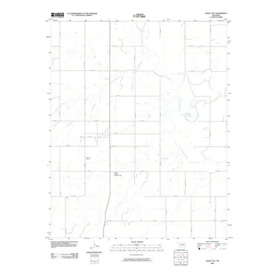
2009 Map of Eagle City
USGS Topo · Published 2009About this map
The North Canadian River winds through the eastern portion of this Blaine County landscape, defining the local hydrology alongside its tributary, Ninemile Creek. In this rural Oklahoma setting, human engineering is marked by the Widney Irrigation Reservoir Dam, indicating the importance of water management for local agriculture in the early twenty-first century. For genealogists and local historians, the Eagle City Cemetery serves as a primary point of interest, located west of the main river valley. The map reveals a strict section-line road grid, including N2470 Rd and E0740 Rd, which organizes the territory and provides access to scattered homesteads and agricultural operations across the prairie.
Find a feature on this map
20 named features on this map. Tap any name to fly to it.
Don’t see what you’re looking for? This feature index may not catch every label — zoom into the map to look around manually.
Map Details
Editions of this 2009 Eagle City Map
This is the sole edition of this map. No revisions or reprints were ever made.
Other maps of this area

1955 · Clinton
USGS Topo · 1:250,000

1955 · Woodward
USGS Topo · 1:250,000

1957 · Clinton
USGS Topo · 1:250,000

1958 · Woodward
USGS Topo · 1:250,000

1964 · Oakwood
USGS Topo · 1:62,500

1972 · Watonga
USGS Topo · 1:24,000

1972 · Canton
USGS Topo · 1:24,000

1972 · Canton SW
USGS Topo · 1:24,000

1972 · Southard
USGS Topo · 1:24,000
1972 · Watonga Lake
USGS Topo · 1:24,000