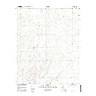
2016 Map of Eagle City
USGS Topo · Published 2016About this map
Eagle City sits at the heart of this Western Oklahoma landscape, defined by a grid of rural section roads and the meandering path of the N Canadian River. The settlement is closely served by the Eagle City Cem to the southwest, a vital point of interest for those researching local family histories and early homesteading patterns in Blaine County. The terrain is deeply etched by drainage systems like Ninemile Cr, which flows toward the river through a series of dramatic contours. Near the center of the sheet, the Widney Irrigation Reservoir indicates the importance of managed water resources in this agricultural corridor. This 2016 survey documents the enduring layout of rural Oklahoma, where large-scale irrigation and historic cemetery sites remain the primary landmarks between the river bends.
Find a feature on this map
21 named features on this map. Tap any name to fly to it.
Don’t see what you’re looking for? This feature index may not catch every label — zoom into the map to look around manually.
Map Details
Editions of this 2016 Eagle City Map
This is the sole edition of this map. No revisions or reprints were ever made.
Other maps of this area

1955 · Clinton
USGS Topo · 1:250,000

1955 · Woodward
USGS Topo · 1:250,000

1957 · Clinton
USGS Topo · 1:250,000

1958 · Woodward
USGS Topo · 1:250,000

1964 · Oakwood
USGS Topo · 1:62,500

1972 · Watonga
USGS Topo · 1:24,000

1972 · Canton
USGS Topo · 1:24,000

1972 · Canton SW
USGS Topo · 1:24,000

1972 · Southard
USGS Topo · 1:24,000
1972 · Watonga Lake
USGS Topo · 1:24,000