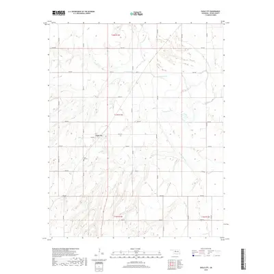
2018 Map of Eagle City
USGS Topo · Published 2018About this map
Eagle City serves as the central hub of this Blaine County landscape, where the flat upland plains are dissected by the meandering course of the N Canadian River. The map captures a rural Oklahoma community structured by a rigorous section-line road grid, including routes like E0740 Rd and N2470 Rd, which facilitate movement across the agricultural terrain. Local history is anchored at the Eagle City Cem, located south of the main settlement. The drainage patterns of Ninemile Cr create a complex topography of draws and ridges that contrast with the more stable river valley to the east. This 2018 representation of the area highlights the persistent organization of the Public Land Survey System, as evidenced by the township markers for t17n r13w and t18n r13w that define the regional boundaries.
Find a feature on this map
24 named features on this map. Tap any name to fly to it.
Don’t see what you’re looking for? This feature index may not catch every label — zoom into the map to look around manually.
Map Details
Editions of this 2018 Eagle City Map
This is the sole edition of this map. No revisions or reprints were ever made.
Other maps of this area

1955 · Clinton
USGS Topo · 1:250,000

1955 · Woodward
USGS Topo · 1:250,000

1957 · Clinton
USGS Topo · 1:250,000

1958 · Woodward
USGS Topo · 1:250,000

1964 · Oakwood
USGS Topo · 1:62,500

1972 · Watonga
USGS Topo · 1:24,000

1972 · Canton
USGS Topo · 1:24,000

1972 · Canton SW
USGS Topo · 1:24,000

1972 · Southard
USGS Topo · 1:24,000
1972 · Watonga Lake
USGS Topo · 1:24,000