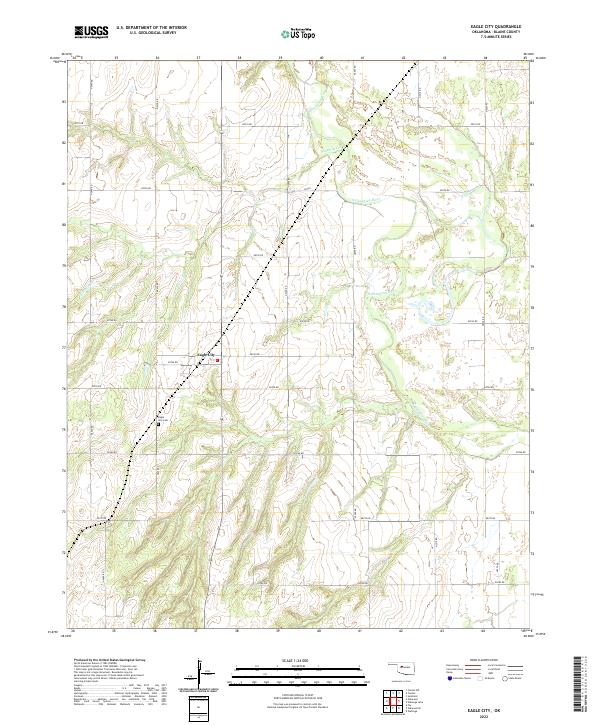
2022 Map of Eagle City
USGS Topo · Published 2022About this map
North Canadian River meanders across this corner of Blaine County, defining the drainage patterns and floodplain of the surrounding prairie. The small settlement of Eagle City sits at a grid intersection, serving as a quiet focal point for the surrounding agricultural sections. The local landscape is marked by the shifting course of Ninemile Creek and the structured township lines of the Public Land Survey System, including t17n r13w. For those researching local families, the Eagle City Cemetery is a prominent landmark situated just south of the town site. This 2022 edition documents the enduring rural road network and the relationship between the river valley and the uplands in a part of Oklahoma defined by its vast wheat fields and section-line roads.
Find a feature on this map
24 named features on this map. Tap any name to fly to it.
Don’t see what you’re looking for? This feature index may not catch every label — zoom into the map to look around manually.
Map Details
Editions of this 2022 Eagle City Map
This is the sole edition of this map. No revisions or reprints were ever made.
Other maps of this area

1955 · Clinton
USGS Topo · 1:250,000

1955 · Woodward
USGS Topo · 1:250,000

1957 · Clinton
USGS Topo · 1:250,000

1958 · Woodward
USGS Topo · 1:250,000

1964 · Oakwood
USGS Topo · 1:62,500

1972 · Watonga
USGS Topo · 1:24,000

1972 · Canton
USGS Topo · 1:24,000

1972 · Canton SW
USGS Topo · 1:24,000

1972 · Southard
USGS Topo · 1:24,000
1972 · Watonga Lake
USGS Topo · 1:24,000