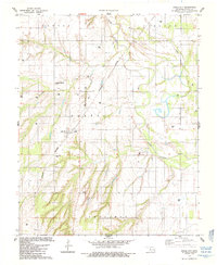
1985 Map of Eagle City
USGS Topo · Published 1985About this map
Eagle City sits at the heart of this mid-1980s landscape in Blaine County, serving as a focal point for the surrounding rural townships of Liberty, Canton, Carlton, and Arapahoe. The town’s spatial layout is defined by the diagonal path of the Burlington Northern railroad, which cuts through the grid and connects the community to broader trade networks. To the south, the Eagle City Cem serves as a significant landmark for genealogists and local historians tracking the area's pioneer families and early residents.
Find a feature on this map
14 named features on this map. Tap any name to fly to it.
Don’t see what you’re looking for? This feature index may not catch every label — zoom into the map to look around manually.
Map Details
Editions of this 1985 Eagle City Map
This is the sole edition of this map. No revisions or reprints were ever made.
Other maps of this area

1955 · Clinton
USGS Topo · 1:250,000

1955 · Woodward
USGS Topo · 1:250,000

1957 · Clinton
USGS Topo · 1:250,000

1958 · Woodward
USGS Topo · 1:250,000

1964 · Oakwood
USGS Topo · 1:62,500

1972 · Watonga
USGS Topo · 1:24,000

1972 · Canton
USGS Topo · 1:24,000

1972 · Canton SW
USGS Topo · 1:24,000

1972 · Southard
USGS Topo · 1:24,000
1972 · Watonga Lake
USGS Topo · 1:24,000