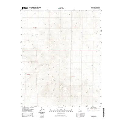
2015 Map of Eagle Crags
USGS Topo · Published 2015About this map
Eagle Crags dominate the interior of this high-elevation quadrangle, where the land rises sharply above the Mojave Desert floor. This 2015 survey identifies a handful of critical water sources essential for survival and navigation in this arid landscape, including Moonshine Spring and Blue Chalcedony Spring. The topography reveals a complex network of ridgelines and drainages within the transition between Township 28 South and Township 29 South. Farther east, Mesquite Spring serves as another isolated landmark in a territory defined by its extreme relief and lack of permanent settlements. The map's detail provides an essential record of the natural hydrologic features and landform elevations that have historically dictated human movement through this corner of San Bernardino County.
Find a feature on this map
9 named features on this map. Tap any name to fly to it.
Don’t see what you’re looking for? This feature index may not catch every label — zoom into the map to look around manually.
Map Details
Editions of this 2015 Eagle Crags Map
This is the sole edition of this map. No revisions or reprints were ever made.
Other maps of this area

1915 · Searles Lake
USGS Topo · 1:250,000

1933 · Avawatz Mountains
USGS Topo · 1:250,000

1947 · Trona
USGS Topo · 1:250,000

1948 · Trona
USGS Topo · 1:250,000

1948 · Quail Mountains
USGS Topo · 1:62,500

1948 · Goldstone Lake
USGS Topo · 1:62,500

1950 · Wingate Pass
USGS Topo · 1:62,500

1951 · Goldstone Lake
USGS Topo · 1:62,500

1951 · Wingate Pass
USGS Topo · 1:62,500

1951 · Quail Mountains
USGS Topo · 1:62,500