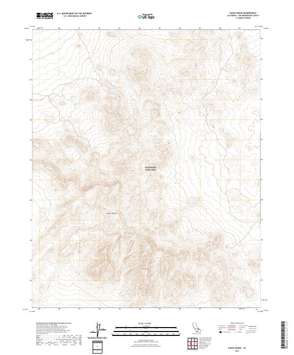
2021 Map of Eagle Crags
USGS Topo · Published 2021About this map
Eagle Crags dominate this section of the Mojave Desert in San Bernardino County, where the topography rises sharply from the arid floor. This 2021 survey illustrates the sparse but critical water resources in the region, noting isolated points such as Moonshine Spring and Blue Chalcedony Spring in the northern highlands, and Mesquite Spring to the southeast. The landscape is characterized by complex contouring and significant elevation changes, with no major roads or human settlements appearing on the sheet. Land management and historical surveying are indicated by the inclusion of township and range boundaries, specifically t29s r45e, which provide essential reference points for researchers tracking public land records or geological survey quadrants in this remote desert environment.
Find a feature on this map
12 named features on this map. Tap any name to fly to it.
Don’t see what you’re looking for? This feature index may not catch every label — zoom into the map to look around manually.
Map Details
Editions of this 2021 Eagle Crags Map
This is the sole edition of this map. No revisions or reprints were ever made.
Other maps of this area

1915 · Searles Lake
USGS Topo · 1:250,000

1933 · Avawatz Mountains
USGS Topo · 1:250,000

1947 · Trona
USGS Topo · 1:250,000

1948 · Trona
USGS Topo · 1:250,000

1948 · Quail Mountains
USGS Topo · 1:62,500

1948 · Goldstone Lake
USGS Topo · 1:62,500

1950 · Wingate Pass
USGS Topo · 1:62,500

1951 · Goldstone Lake
USGS Topo · 1:62,500

1951 · Wingate Pass
USGS Topo · 1:62,500

1951 · Quail Mountains
USGS Topo · 1:62,500