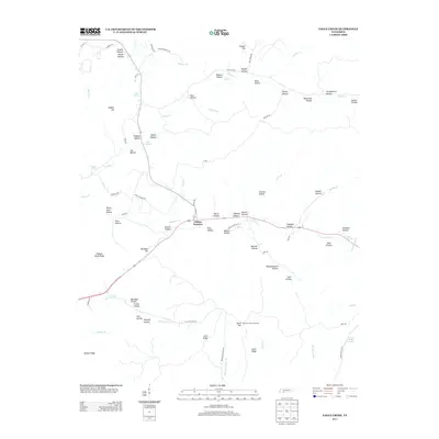
2013 Map of Eagle Creek
USGS Topo · Published 2013About this map
Clifton Junction serves as the central hub for this portion of Wayne County, where Tennessee State Route 114 meets the winding paths of Hardin Cr. The landscape is defined by an intricate network of deep hollows named for early residents and landmarks, such as Hideout Hollow, Sheep Cave Hollow, and Keeton Hollow. This 2013 survey illustrates the rugged topography between the Dickson Bluff Ridge and Dugout Hill, revealing how modern roads like the Clifton Tpke follow the natural contours of the land. Water is a defining element of the local geography, with numerous named sources like Cave Spring, Alley Spring, and Walker Spring feeding into the larger drainage systems of Eagle Cr and Mill Cr. The presence of the Hardins Creek Fire Tower on a prominent rise overlooking the hollows highlights the enduring importance of forest management in this heavily timbered region of Middle Tennessee.
Find a feature on this map
85 named features on this map. Tap any name to fly to it.
Don’t see what you’re looking for? This feature index may not catch every label — zoom into the map to look around manually.
Map Details
Editions of this 2013 Eagle Creek Map
This is the sole edition of this map. No revisions or reprints were ever made.
Other maps of this area

1905 · Waynesboro
USGS Topo · 1:125,000

1936 · Wolf Pit Ridge
USGS Topo · 1:24,000

1936 · Eagle Creek
USGS Topo · 1:24,000

1936 · Olivehill
USGS Topo · 1:24,000

1936 · Bath Springs
USGS Topo · 1:24,000

1936 · Leatherwood
USGS Topo · 1:24,000

1936 · Clifton
USGS Topo · 1:24,000

1936 · Three Churches
USGS Topo · 1:24,000

1936 · Waynesboro
USGS Topo · 1:24,000

1936 · Martins Mills
USGS Topo · 1:24,000