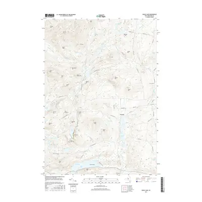
2016 Map of Eagle Lake
USGS Topo · Published 2016About this map
Ironville serves as the primary settlement center within this portion of the Adirondack Park, where the geography is defined by a series of steep ridges and numerous isolated ponds. The industrial history of the region is evident through features like Ore Bed Bay on the shores of Eagle Lake and the prominent heights of Furnace Mtn and Railroad Hill. These names suggest a legacy of mineral extraction and transport that once shaped the local economy. The landscape is interconnected by historic routes such as Old Furnace Rd and Stoney Lonesome Rd, which skirt the bases of peaks like Bald Pate and Skiff Mtn. To the north, the terrain rises toward Bloody Mtn and Hall Mtn, while the drainage of Mill Brook and Putnam Cr carves through the valleys, sustaining Penfield Pond and Ingalls Marsh.
Find a feature on this map
90 named features on this map. Tap any name to fly to it.
Don’t see what you’re looking for? This feature index may not catch every label — zoom into the map to look around manually.
Map Details
Editions of this 2016 Eagle Lake Map
This is the sole edition of this map. No revisions or reprints were ever made.
Other maps of this area

1894 · Elizabethtown
USGS Topo · 1:62,500

1894 · Port Henry
USGS Topo · 1:62,500

1894 · Ticonderoga
USGS Topo · 1:62,500

1895 · Elizabethtown
USGS Topo · 1:62,500

1895 · Paradox Lake
USGS Topo · 1:62,500

1896 · Ticonderoga
USGS Topo · 1:62,500

1897 · Paradox Lake
USGS Topo · 1:62,500

1898 · Port Henry
USGS Topo · 1:62,500

1901 · Elizabethtown
USGS Topo · 1:62,500

1902 · Ticonderoga
USGS Topo · 1:62,500