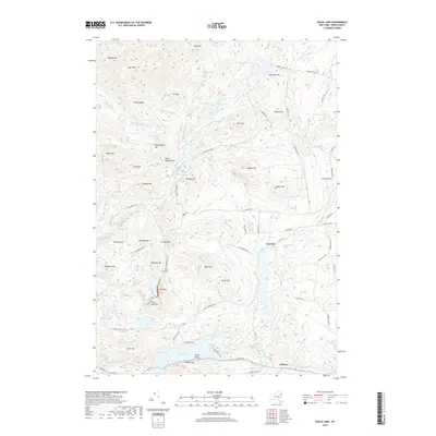
2019 Map of Eagle Lake
USGS Topo · Published 2019About this map
Ironville and Chilson anchor the southeastern portion of this terrain within the Adirondack Park. The landscape is defined by its industrial past, particularly noted by the presence of Furnace Mtn, Old Furnace Rd, and Railroad Hill, which allude to the historical iron mining and smelting operations that once thrived in this part of Essex County. Water is a dominant feature, from the elongated reach of Eagle Lake to smaller catchments like Goosepuddle Pond and Overshot Pond. The map reveals a network of old roads such as McMurtry Rd and Stoney Lonesome Rd that wind through peaks including Bloody Mtn and Skiff Mtn. To the west, the expansive Ingalls Marsh provides a distinct contrast to the surrounding ridges, while Crown Point Bay and Ore Bed Bay along the lakefront suggest early settlement and resource extraction points.
Find a feature on this map
91 named features on this map. Tap any name to fly to it.
Don’t see what you’re looking for? This feature index may not catch every label — zoom into the map to look around manually.
Map Details
Editions of this 2019 Eagle Lake Map
This is the sole edition of this map. No revisions or reprints were ever made.
Other maps of this area

1894 · Elizabethtown
USGS Topo · 1:62,500

1894 · Port Henry
USGS Topo · 1:62,500

1894 · Ticonderoga
USGS Topo · 1:62,500

1895 · Elizabethtown
USGS Topo · 1:62,500

1895 · Paradox Lake
USGS Topo · 1:62,500

1896 · Ticonderoga
USGS Topo · 1:62,500

1897 · Paradox Lake
USGS Topo · 1:62,500

1898 · Port Henry
USGS Topo · 1:62,500

1901 · Elizabethtown
USGS Topo · 1:62,500

1902 · Ticonderoga
USGS Topo · 1:62,500