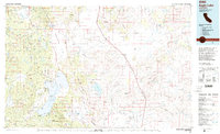
1992 Map of Eagle Lake
USGS Topo · Published 1992About this map
Eagle Lake dominates the western portion of this High Desert landscape, its intricate shoreline defined by Buck Bay, Miners Bay, and Troxel Point. Small lakeside developments like Spalding Tract and landmarks such as Merrill Lodge mark the human footprint near the water, while the Southern Pacific railroad cuts a long diagonal path through the high plains to the east. The map illustrates a stark contrast between the complex aquatic and volcanic features of the Brockman Flat Lava Beds and the broad, open expanses of the Madeline Plains and Grasshopper Valley.
Find a feature on this map
76 named features on this map. Tap any name to fly to it.
Don’t see what you’re looking for? This feature index may not catch every label — zoom into the map to look around manually.
Map Details
Editions of this 1992 Eagle Lake Map
2 editions found
Other maps of this area

1886 · Alturas
USGS Topo · 1:250,000

1886 · Honey Lake
USGS Topo · 1:250,000

1886 · Lassen Peak
USGS Topo · 1:250,000

1886 · Modoc Lava Bed
USGS Topo · 1:250,000

1886 · Granite Range
USGS Topo · 1:250,000

1889 · Long Valley
USGS Topo · 1:250,000

1891 · Honey Lake
USGS Topo · 1:250,000

1892 · Modoc Lava-Bed
USGS Topo · 1:250,000

1892 · Lassen Peak
USGS Topo · 1:250,000

1892 · Alturas
USGS Topo · 1:250,000