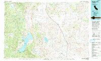
1992 Map of Eagle Lake
USGS Topo · Published 1992About this map
Eagle Lake dominates this high-altitude landscape of Lassen County, where the transition from forest to high desert is clearly defined by volcanic terrain. The northwestern edge is marked by the Lassen National Forest and the Brockman Flat Lava Beds, illustrating the region's geological history. Settlement patterns follow the Southern Pacific railroad corridor, which cuts across the Madeline Plains, connecting the small communities of Termo and Ravendale.
Find a feature on this map
106 named features on this map. Tap any name to fly to it.
Don’t see what you’re looking for? This feature index may not catch every label — zoom into the map to look around manually.
Map Details
Editions of this 1992 Eagle Lake Map
2 editions found
Other maps of this area

1886 · Alturas
USGS Topo · 1:250,000

1886 · Honey Lake
USGS Topo · 1:250,000

1886 · Lassen Peak
USGS Topo · 1:250,000

1886 · Modoc Lava Bed
USGS Topo · 1:250,000

1886 · Granite Range
USGS Topo · 1:250,000

1889 · Long Valley
USGS Topo · 1:250,000

1891 · Honey Lake
USGS Topo · 1:250,000

1892 · Modoc Lava-Bed
USGS Topo · 1:250,000

1892 · Lassen Peak
USGS Topo · 1:250,000

1892 · Alturas
USGS Topo · 1:250,000