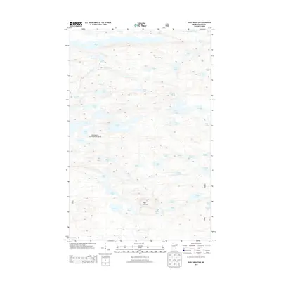
2013 Map of Eagle Mountain
USGS Topo · Published 2013About this map
Eagle Mountain and the Misquah Hills dominate this high-relief landscape within the Superior National Forest. This 2013 survey illustrates a dense network of glacial lakes and rugged interior terrain, characteristic of the Boundary Waters region. Notable water bodies including Winchell Lake to the north and the expansive Brule Lake to the south define the hydrological character of the area.
Find a feature on this map
55 named features on this map. Tap any name to fly to it.
Don’t see what you’re looking for? This feature index may not catch every label — zoom into the map to look around manually.
Map Details
Editions of this 2013 Eagle Mountain Map
This is the sole edition of this map. No revisions or reprints were ever made.
Other maps of this area

1919 · Brule Lake
USGS Topo · 1:62,500

1954 · Two Harbors
USGS Topo · 1:250,000

1957 · Two Harbors
USGS Topo · 1:250,000

1957 · Quetico
USGS Topo · 1:250,000

1958 · Two Harbors
USGS Topo · 1:250,000

1959 · Lima Mountain
USGS Topo · 1:24,000

1959 · Hungry Jack Lake
USGS Topo · 1:24,000

1960 · Tait Lake
USGS Topo · 1:24,000
1960 · Devil Track Lake
USGS Topo · 1:24,000

1960 · Mark Lake
USGS Topo · 1:24,000